Follow us on Google News (click on ☆)

Image Wikimedia
Volcanoes consist of a complex arrangement of fractured rocks, pockets of liquid, and gases so heterogeneous that imaging them is particularly challenging. Seismic tomography uses earthquakes to probe their mechanical properties, but it requires significant seismic activity, and the resolution of the resulting images is only on the order of a few kilometers.
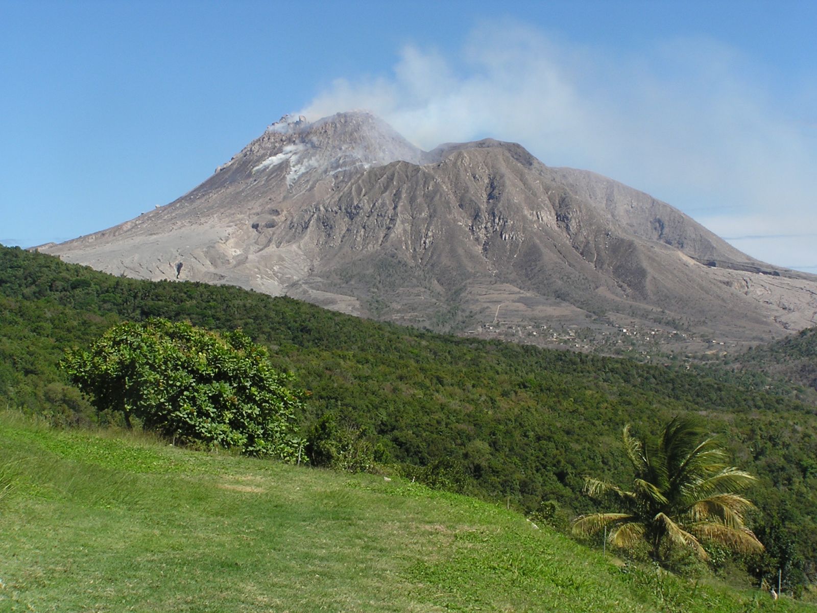
Researchers from the Langevin Institute (CNRS/ESPCI Paris - PSL University) and the Institut de physique du globe de Paris (Université Paris Cité/CNRS) have developed a new imaging method, called passive matrix imaging, which probes the depths of the volcano up to six miles (10 km) and resolves its internal plumbing system with a precision on the order of hundreds of meters using only seismic noise.
These results were obtained on the La Soufrière volcano in Guadeloupe. They reveal the tortuous shape of the volcano's upper chimney. Most importantly, they confirm the existence of a large magma storage zone deep beneath the surface, structured as a network of interconnected horizontal magma lenses. In addition to confirming some conceptual models proposed in the literature, such images offer a unique vantage point on volcanoes, with the potential to revolutionize the field of volcanology.
To achieve this, the scientists, in collaboration with the Guadeloupe Volcanological and Seismological Observatory (OVSG-IPGP), deployed a sparse network of geophones, which capture not only the strong tremors of earthquakes but also the seismic noise induced by wind, the ocean, and human activity.

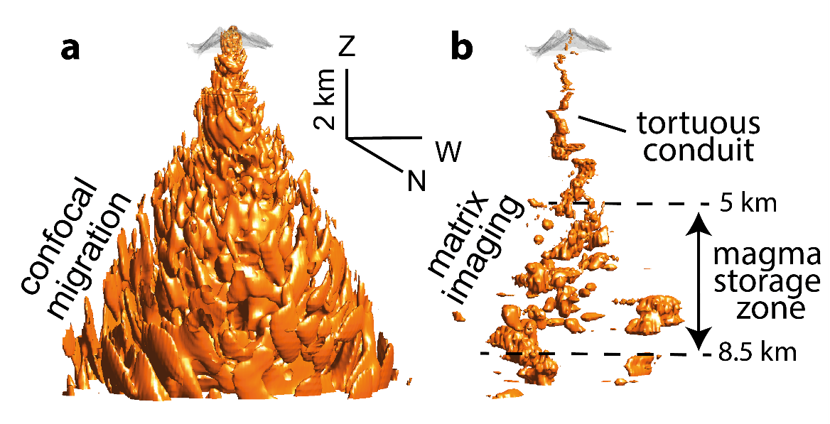
a) Three-dimensional view of the volcano obtained by confocal migration of the reflection matrix. The image is completely blurred by the distortions of seismic waves caused by the volcano's heterogeneities.
b) Matrix image of the volcano obtained by learning focusing laws that compensate for these heterogeneities. Up to 3 miles (5 km), the image reveals the tortuous conduit of La Soufrière. Beyond that, a magma storage zone is highlighted with a complex arrangement of interconnected horizontal magma lenses.
© Elsa Giraudat
This seismic noise, measured over two months, was used to construct a reflection matrix, inspired by previous work from the same team on ultrasonic imaging and optical microscopy, recently published in Nature Communications.
This matrix is used to finely compensate for the distortions that seismic waves undergo as they traverse the various geological structures and magma pockets within the volcano. These heterogeneities no longer pose an obstacle, and an image of the volcano's internal structure is obtained as if the volcano had become transparent.
This passive matrix imaging technique can be applied to any volcano, provided a dense network of geophones is deployed. Hence, it opens up a vast field of applications in volcanology to better understand the internal structure of volcanoes and the movements of magma deep below the surface, enabling more effective forecasting of volcanic eruptions.
References:
E. Giraudat, A. Burtin, A. Le Ber, M. Fink, J-C. Komorowski & A. Aubry.
Matrix imaging as a tool for high-resolution monitoring of deep volcanic plumbing systems with seismic noise.
Commun Earth Environ 5, 509 (2024). DOI: 10.1038/s43247-024-01659-2.