🏔️ A vast network of giant canyons discovered beneath Antarctica
Published by Cédric,
Article author: Cédric DEPOND
Source: Marine Geology
Other Languages: FR, DE, ES, PT
Article author: Cédric DEPOND
Source: Marine Geology
Other Languages: FR, DE, ES, PT
Follow us on Google News (click on ☆)

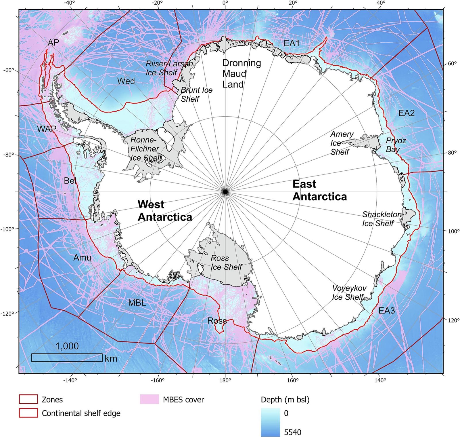
Overview of the study area, with subdivision of zones and extent of MBES coverage. Abbreviations mean:
- Antarctic Peninsula (AP),
- Western Antarctic Peninsula (WAP),
- Weddell Sea (Wed),
- East Antarctica 1 to 3 (EA1–3),
- Ross Sea (Ross),
- Marie Byrd Land (MBL),
- Amundsen Sea (Amu)
- and Bellingshausen Sea (Bel).
A contrasting submarine geography
The eastern coast of the continent hosts complex, branched systems. These canyons exhibit wide U-shaped profiles, indicating a long evolution under the persistent action of glaciers. Their multiple heads often converge toward a single main channel.
The western coast presents a radically different underwater landscape. The canyons there are generally shorter and steeper. Their walls form narrow V-shaped gorges, characteristic of more recent and intense erosion processes.
This morphological divergence supports a major geological hypothesis. The East Antarctic ice sheet is believed to have a much older origin than its western counterpart. Previous sediment studies corroborate this interpretation.
Key players in the climate system
These submarine valleys function as highways for water masses. They facilitate exchanges between deep waters and the continental shelf. This mechanism is vital for the formation of cold, dense waters.
The canyons also channel warmer waters toward the coasts. This process accelerates the basal melting of floating ice shelves. The stability of continental glaciers depends directly on this.
The absence of these structures in climate models limits their accuracy. Projections of sea level rise could thus gain in reliability. Better integration of these landforms is therefore essential.