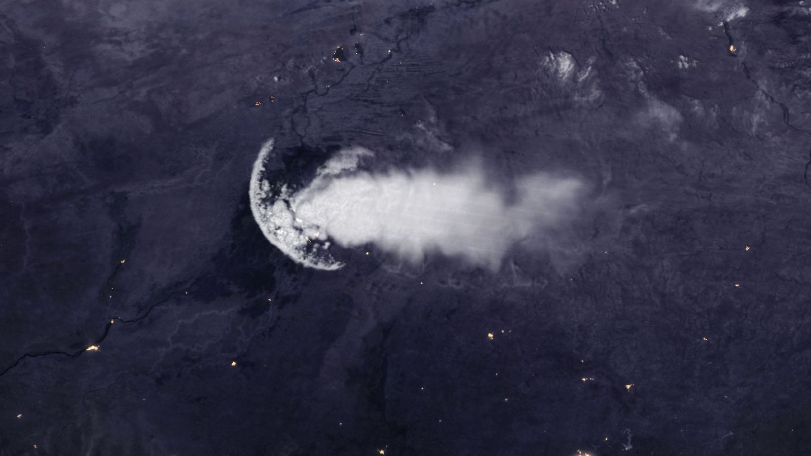
What is this 180-mile-long "jellyfish" seen from space?
Follow us on Google News (click on ☆)
This unusual cloud, approximately 186 miles (300 kilometers) long, was spotted by the Suomi NPP weather satellite, jointly operated by NASA and NOAA. The "bell" of the jellyfish was located above the city of Mopti, while the "tentacles" stretched down to Burkina Faso, according to NASA's Earth Observatory.

This strange cloud is the result of a meteorological phenomenon known as a gust front. It is a fast-moving shockwave of air that radiates from storm clouds (see below). Usually, this creates a large disc of elevated clouds, called roll clouds or shelf clouds, which often resemble an anvil when seen from the ground.
But in this case, only part of the disc formed because the gust front was partially disrupted by wind shear, explained Joseph Munchak, a meteorologist at NASA's Goddard Space Flight Center.
In dry regions, gust fronts can lift dust and sand, creating short-lived walls of particles called haboobs, according to Earth Observatory. These dust storms, which typically last a few minutes, often appear suddenly after thunderstorms and can drastically reduce visibility and air quality, according to the National Weather Service.
Gust front
A gust front is a band of fast-moving air that forms at the Earth's surface due to downdrafts from a thunderstorm. When cold air descends from storm clouds and reaches the surface, it rapidly spreads outward, forming an expanding shockwave of air. This phenomenon is similar to the ripples created when a stone is thrown into water. The gust front lifts the warm, moist air above it, which can form characteristic clouds such as roll clouds or shelf clouds.
The formation of gust fronts is often associated with sudden weather changes, such as wind gusts and rapid temperature drops. In arid regions, they can lift large amounts of dust and sand, creating dust storms called haboobs. These dust storms reduce visibility and can have significant impacts on air quality and transportation safety.